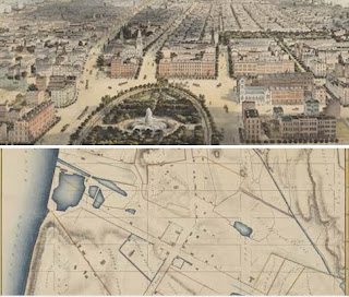
"For the first two hundred years of Manhattan history, the Collect Pond, a lovely, spring-fed reservoir that bubbled up on the border of what is now Chinatown and the Financial District, was the main water source for most city dwellers. The streets grew up organically around it, private roads bounded by a vacant, rocky, wasteland to the north, from what is now 23rd to 90th streets. These were the city-owned Common Lands, and after the revolution they were something the debt-ridden city needed to parcel out and sell fast."
brain pickings
anazon: The Greatest Grid: The Master Plan of Manhattan, 1811-2011
Museum of the City of New York
No comments:
Post a Comment